Measuring
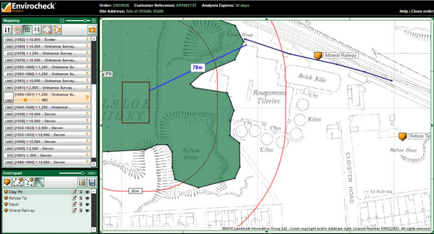
Envirocheck Analysis provides the facility to take length measurements on the map for your analysis using the dynamic measuring tool.
 Measuring
| 1. | To measure the distance between two features on the map click the Use Ruler button  . This is located in Enviropad in the bottom left-hand corner of the screen. . This is located in Enviropad in the bottom left-hand corner of the screen. |
| 2. | Move the cursor onto the map and you will notice it has changed to an arrow with a ruler  . When you are over the point on the map you would like to measure from, hold down the left mouse button and move your cursor to the point on the map you would like to measure to. . When you are over the point on the map you would like to measure from, hold down the left mouse button and move your cursor to the point on the map you would like to measure to. |
| 3. | Release the mouse button and a blue line will be on the map with a text box indicating the length measurement in metres: |

Each new measurement will clear the previous one.
Next: Adding Site Notes

